 Placer
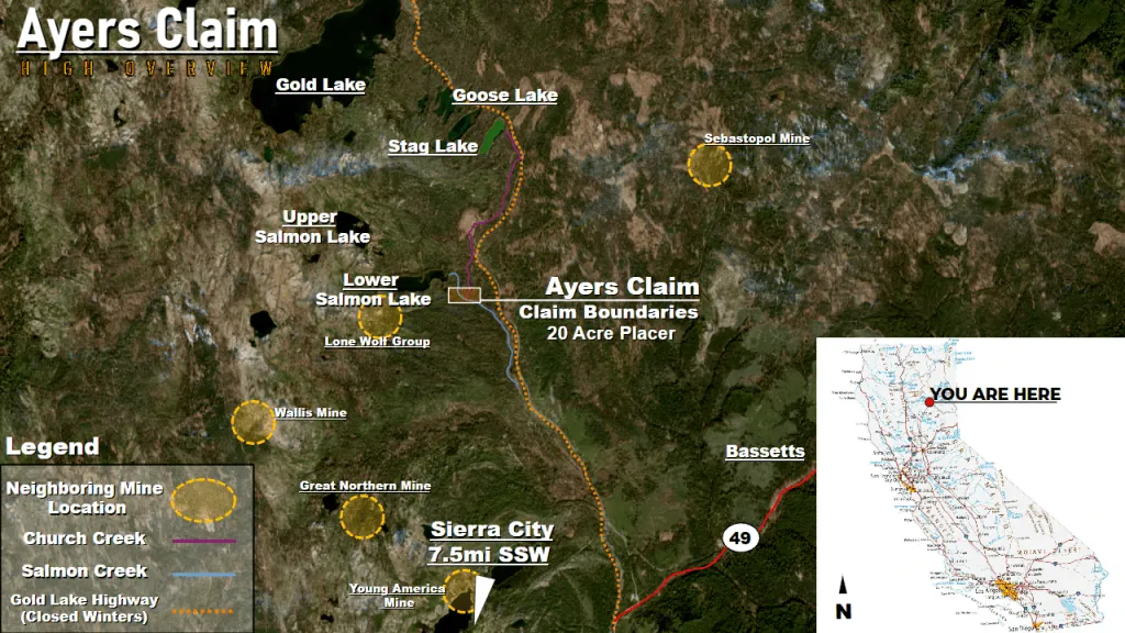
Ayers Claim
📍 Sierra County, California
- Au
- Ag
$6,500
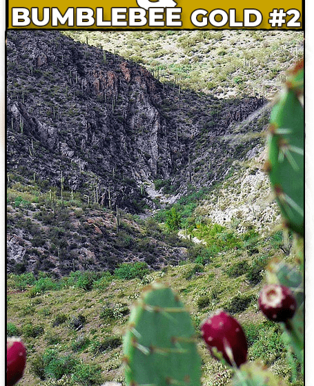
20.66 Acre Lode Mining Claim · Turkey Creek District · Yavapai County, Arizona
$5,500 $3,750
Reduced price! All BLM & county filing fees included. 10-day transfer guaranteed.
One Small Arizona Gold Claim for Sale
In the heart of Arizona’s Turkey Creek Mining District lie the Marigold #1 & the Bumblebee Gold #2; 20-acre placer and 20.66 acre lode claims! These claims are the envy of local miners: In an area where patented and unpatented claims stretch for miles chasing the rich, feet-thick veins found across the Turkey Creek Mining District, staking new unpatented mining claims in this area is almost impossible — and getting your hands on one in this area is a rare opportunity!
With its history starting in the 1870s, the Turkey Creek Mining District has seen decades of work from nearly a hundred mines and thousands of prospectors, stopping only from governmental pressures due to the Second World War. With the labor shortage that followed the war, the district was mostly forgotten and abandoned… but all of its riches still remain half-mined!
This means the Marigold #1 & Bumblebee Gold #2 are surrounded by dozens of past producing mines. Chasing large veins, some reportedly stretching as far as 3/4ths of a mile before fracturing, mines such as the War Eagle, the Gold Note, the Roach, the La Plata Grande, and the aptly named Trinity Mine, just to name a few, all mined for the Treasured Trinity of gold, silver, and copper. With nearby mines taking in profits as high as $60,000 during their 1900s hay-day (about $1 million today), the area gave plenty of gold to everyone that could plant a stake in it!
Please note! The Marigold #1 has SOLD! Only the Bumblebee Gold #2 remains!
To make matters better, the Treasured Trinity seems to be easy to find within the Turkey Creek District. Neighboring mines in the area have found valuable ore outcroppings visibly close to the surface, owing to the incredible natural geology of this section of the Turkey Creek Mining District: as the meeting place between intrusive plutonic bodies (granodiorite, gabbro-diorite, quartz-monzonite) and meta-volcanic and meta-sedimentary bodies (e.g. migmatite), well-defined, existing fractures and foliations within these host rock bodies have allowed an incredible amount of mineralization through both metamorphic and metasomatic activity — of which, the Marigold & Bumblebee both find themselves in the “fault channel” of!
Collecting the minerals using dozer cuts close to the surface or sinking a deep shaft to chase the veins have allowed these neighboring mines to taste the gold underneath the dusty surface of the Bradshaw Mountains. The same techniques continue to apply for other and newer mines in the area.
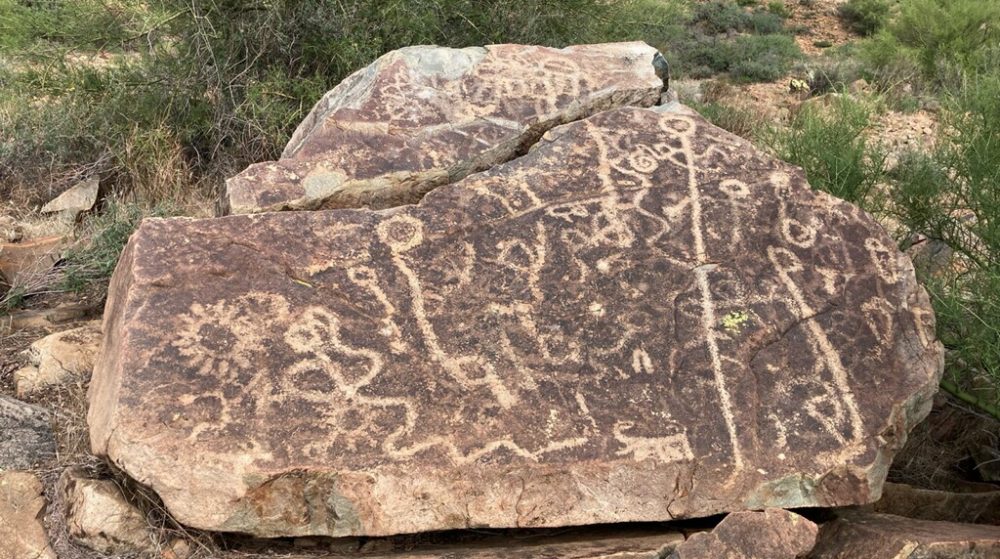
Outside of mining, the Marigold and Bumblebee claims hold a unique secret. Prospectors in the area were amazed when they happened upon some old historical relics. After having spotted what appeared to be a tombstone inscribed with the date 1802 on it, they later stumbled a large stone with petroglyphs upon it!
The area speaks for itself. Like the mining boom-town of Jerome, dozens of properties dot the hills leading up to the claims within the Potato Patch. Once patented mining claims, the gold and silver mined from below their foundations (and may still be!) purchased the very land and homes that stand on it today. While these smaller mines have now become the homesteads for their families, larger, more ambitious mines are still active in the area, such as the Davis Dunkirk mine — a mine that took in $200,000 in its 1920s hayday (merely ~$3,250,000 today).
Access is not an issue with all the homesteads in the area, as there are well-maintained dirt roads that lead up to Potato Patch and the surrounding hillsides. Smaller dirt roads, of various maintenance quality and width, lead directly to both claims. A good 4x4 vehicle is recommended, although lesser off-road-capable vehicles can likely manage getting up to the homesteads, leaving a 1/2-mile walk to the claims on trails.
The mining boom town of Jerome — not much unlike the homesteads surrounding the Marigold!
If you’re interested in purchasing these unpatented, small gold claims for sale, please email me here.
The Bradshaw Mountains — Image courtesy of Ranger Robb
| Type of Claim | Unpatented Claim; AZ101388320 (Lode) |
|---|---|
| Size of Claim | 20.66 ACRES |
| Mining Commodities | Gold, Silver, Copper, Lead, Zinc |
| Accessibility | Well-Maintained Dirt Roads |
| Closest City | Prescott, Arizona |
| Camping | Yes. Up to 14 days at a time |
| Prior Workings | None |
| Cell Phone Reception | Some Bars on AT&T Networks |
| Type of Deposit | Lode |

| NE | 34.379332°, -112.381893° |
|---|---|
| NW | 34.379343°, -112.383988° |
| SE | 34.375449°, -112.381842° |
| SW | 34.375442°, -112.383964° |
| Monument | 34.379188°, -112.382985° |
|---|
Corner and monument coordinates (WGS84) read from the claim’s official Google Earth KMZ boundary file.
| Operation type | Lode |
|---|---|
| Development status | Prospects |
| Commodity type | Gold, Silver, Copper |
| Deposit size | Unknown |
| District Name | Turkey Creek Mining District, Yavapai County |
|---|---|
| Deposit MAS/MILS ID |
War Eagle Mine Trinity Mine Gold Note Mine Roach Mine – MRDS#10283822 La Plata Grande – MRDS#10259084 |
| Type of Structure | Early Proterozoic Granitic Rocks |
|---|---|
| Structure Description |
(MAJOR) — Plutonic Granite Igneous > Plutonic > Granitic > Tonalite Igneous > Plutonic > Granitic > Granodiorite Igneous > Plutonic > Granitic > Granite MINOR — Plutonic Gabbo-Diorite Igneous > Plutonic > Dioritic > Diorite Igneous > Plutonic > Gabbroic > Gabbro Igneous > Plutonic > Dioritic > Quartz-diorite |
A mining claim gives the holder the right to mine on mineral-rich land that belongs to the federal government. Mining claims are a tangible asset and show proof of all interests in minerals in the area. They can be bought, sold or used as collateral, just like any other piece of real estate.
A mining claim can be sold, traded, leased, gifted, willed, used as collateral or transferred in part or in its entirety just like any other real property using a quitclaim deed which is a recordable conveyance. Questions about the transfer process can be answered by contacting us anytime. All fees and paperwork current and assessment fees are paid through Sept. 1st 2026.
$3,750
Cash Price
Make a one time payment and get new mineral rights transferred in your name quick and easy.
Buy Online NowEmail me for more information and additional payment options.
After your purchase is complete you will be requested to fill out our new claim owner form with your name/address or add any additional claimants you want on the claim.
You’ll get digital copies of your COL and Map of Location in to your claim(s) will be delivered via email via PDF format as well as Google Earth™ KMZ map file with your claims discovery, corners and points of interest.
We handle all the filing and transfer services on your behalf. Expect to get official stamped/recorded copies of your paperwork mailed to you from the Yavapai County Recorder’s Office and the Arizona Bureau of Land Management officiating you as the new claimant within 45 days of purchase. Then officially enjoy mining gold on your own land!
Bumblebee Gold #2 is a 20.66 acre lode mining claim located in the Turkey Creek District of Yavapai County, Arizona. This claim offers an excellent entry-level opportunity into Arizona hardrock mining at a reduced price.
Primary and secondary commodities on this claim include:
The Turkey Creek District is known for its porphyry copper and associated gold-silver mineralization. The area’s geology features Precambrian metamorphic basement rocks overlain by Tertiary volcanic units, with intrusion-related mineralization throughout the district.
The Bumblebee Gold #2 claim is situated in central Arizona’s mineral-rich terrain. The claim area is characterized by:
This claim represents an affordable opportunity to own hardrock mineral rights in one of Arizona’s established mining districts.
The Turkey Creek District in Yavapai County has a history of copper, gold, and silver production dating back to the late 1800s. The district is part of Arizona’s extensive porphyry copper province, with mineralization associated with granitic intrusions into older metamorphic and volcanic rocks.
The area has seen intermittent mining and exploration activity over the decades, with modern prospectors continuing to explore the district’s numerous vein systems and alteration zones. The relatively mild climate of central Arizona allows for year-round exploration and mining activities.
Satellite view of the claim area. Click the pin for a quick summary.
Approximate district-level location shown to protect the exact claim boundaries. Contact us for precise coordinates and a guided map.
Explore other active lode and placer claims.